| Fudeyang Waterway |
| The History
Shilin is located at the northern tributaries of the Keelung River, namely the area of Shuangxi, Shezi, and the Sulfur Creek, and is the land area between the Tamsui River, Tatun volcano group and Jiantanshan. It is the fishing and hunting ground for kimassauw and wauli communities of Ketagalan people of the Pingpu tribe, especially being the earliest settlements with abundance of historical relics and space culture in the Taipei Basin.
In 1694 of Kangxi reign, a major earthquake occurred in the Guandu area, causing the river to rise and protrude inland to form the Kangxi Taipei Lake. And, with several continuous aftershocks, liquefaction of the soil quickly turned many parts of the Taipei Basin to sink further downward that the subsidence of the strata caused the river to flood even more. The submerged area of the Kangxi Taipei Lake included the sandbars at the lower reaches of the Keelung River and the main section of the Tamsui River before reaching Gandu, which covered a part of the Guandu Plain, Shezidao, Zhoumei, Beitou, Shilin, Wugu, Sanchong, Luzhou, etc., and the center of the Kangxi Taipei Lake was around the current Sanchong and Luzhou areas. At that time, approximately in the current area of today’s Shezidao, the aborigines of the three communities such as kimassauw lived on the lower bank of the Keelung River, that is, they moved to Shilin and Tianmu to avoid the flooding. Once the water receded and the land (or the sandbar) re-emerged, the continuous siltation of the Tamsui River and the Keelung River built up several new places, including the current Houganqian, Huludu, Shezi, Sijhoudi, Xishawei, Fuzhou, etc., for residential settlements.
About the seventeenth century, Han people started migrating from the Mainland. By the early eighteenth century, Shilin was still on the edge of the Kangxi Taipei Lake and the land reclamation and cultivation started near these new tidal lands at the intersection between the lake, Shuangxi and the Sulfur Creek, becoming the initial start locations of Han immigration, that is, specifically on the west wide of Xiashulin tidal land, which is the area of the current Shin Kong Wu Ho Shu Memorial Hospital, this marked the opening of the very chapter of our ancestral pioneers as settlers of the new land.
The number of Han settlers dramatically increased in the 18th century and most of them were from Zhangzhou of the Mainland. About the 42nd year of Kangxi reign (Year 1703), by the time when Cheng Weichien, a settler from Zhangzhou, came over to Taiwan, many of the immigrants from Zhangzhou had already cultivated the land of Xiashulin, built a community of huts and constructed fude temple for worshiping the Earth God. This area was eventually named as Dianzai street and later renamed Zhilan Street. In 1720, while Cheng Weichien was cultivating the land of Shilin, this place was referred to as Pattsiran community. In the first year of Yungzheng reign (Year 1723), two strongholds, namely Qiàn and Tamsui, were established under the control of Tan-shui T’ing, under which, there were 18 villages and one of which was named Pattsiran. Also, in this year, residents started to build more shops and because of the booming blossoms of wild orchids in this region, this place was also called Lanlinjian. A few years later, the population gradually increased and by the first year of Qianlong reign (Year 1736), the excavated canal was named Fudeyang waterway to provide the areas around Shilin with stable water source for farming and land reclamation. The water intake of Fudeyang waterway is currently next to the campus of Soochow University at Waishuangxi. Around the 2nd year of Qianlong reign (Year 1737), the Dongshi tidal land of kimassauw community was transformed into Pattsiran Village and most people had resided at the intersection of Shuangxi and Keelung River, as well as the more inland area of Zhishanyan. In the 6th year of Qianlong reign (Year 1741), Zhangzhou people expanded the original fude temple on the bank of Shuangxi River and built it into the Zhilan Temple, which was later renamed Shennong Palace. The street in front of the temple was called “qianjie”, where residents gathered in clusters to develop local economy as a northern cargo distribution center. Over the years, the street of Shennong Palace expanded and became the earliest historical space of Shilin, which was often referred to as Zhilan Old Street by later generations. In the 11th year of Qianlong reign (Year 1746), the village was officially named Pattsiran and by the 29th year of the reign (Year 1764), it was then renamed Zhilan. In the 9th year of Xianfeng reign (Year 1859), the people of Zhangzhou and Quanzhou fought with each other, and the battlefield was extended to Shilin. The old street where Shennong Palace was located was completely destroyed, and a new street named “Xiashulin” took its place, which remained so until the end of Qing Dynasty when the place was finally settled with the name of “Shilin”.

The source of Fudeyang waterway has its water intake at Waishuangxi outside the second Teaching and Research Building of Soochow University. The name was a transliteration of “De Yang” in Taiwanese dialect, also known as “the plain”. The Keelung River, Shuangxi and Jiantanshan enclose a triangular plain, which is adjacent to the river of Waishuangxi Basin, providing convenient transportation to the outside world via water or rail. From the 42nd year of Kangxi reign (Year 1703) to the 8th year of Xianfeng reign (Year 1858), only Zhilan New Street and the Old Street (formerly known as Zhilan Street) were the official streets under city planning, while the remaining areas were all paddy rice fields until the Japanese-Occupied Period, when more planned streets were developed along the Tamsui Line Railway.
This became the place of ancestors’ gathering, where the community residents built the first temple of the Earth God (currently near Shin Kong Wu Ho Shu Memorial Hospital), given the place the name “Fude” in respect to the diety. Shennong Palace, the earliest fude temple in Shilin, was originally named “Zhilan Temple”, in dedication to the Earth God, and an old map of ancient Shilin was kept in the temple. Since the triangular plain was called “Fudeyang”, it symbolizes the land being blessed by the Earth God himself. The water required of the farmlands in this vast plain was built by the tenants such as the Wu Family of Shilin in the first year of Qianlong reign (Year 1736). Due to the ancestors’ cultivation effort, with the water taken from the upper reaches of Waishuangxi, not only did it irrigate and nourish lands of Linzikou, Xizhouzi, Xiashulin, Fudeyang (near Zhouweitou), etc., but also provided water for residential use and even industrial use at Shilin Paper Factory during the Japanese-Occupied Period, truly deserving the title of “Fudeyang waterway”. It is about seven kilometers in length and extracts water from the upper reaches of Shuangxi. The water will flow through the canal along the left bank of Shuangxi and bifurcated at the area of Shuangxi Park near Taibei International Junior High School, which is divided into the primary north branch to irrigate the land of Zhoumei in the west and the secondary south branch around the Shilin Market to merge into the Keelung River.
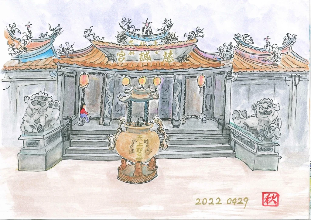
As early ancestors settled in Fudeyang, they were forced to relocate from the upper reaches of the Keelung River to Shuangxi (near Shennong Palace) due to the flooding by typhoons, where they really began to cluster and develop local economy, and called the place Pattsiran Street. During the Xianfeng reign, the well-known incident of internecine strife between Zhangzhou people and Quanzhou people had left many houses burned down and the eager effort to rebuild was met with disastrous flooding. It was not until Pan Yungching of a local prominent family planned the city streets with a new Mazu temple (aka. Cixian Temple) designated as the village center, that his leadership led everyone to relocate and helped Zhilan New Street prosper a few months later, as the old street of Zhilan was soon forgotten and fell behind in the wake of such new development. In January 1896, the “Zhishanyan Incident” occurred in Shilin, where six Japanese teachers were killed and Pan Yungching’s son, Pan Guangsong (then the Director of Community Watch) was implicated and killed by the Japanese. In 1901, the Tamsui Line Railway was officially opened and a new railway station was set up in Shilin, which led to more spatial development, including a township administration and the train station all nearby the town circle. In 1915, the Japanese planned a “public market” on the north side of Danan Road, and later in 1918, the predecessor of “Shihlin Paper Corporation” was established in the barren land and cemetery area on the south side of the waterway near Dabei Road, which was then called “Taiwan Paper K.K”. In 1950, the former President Chiang Kai-Shek set up his official residence in Jiantanshan of Shilin, placing the region under military control, as many military and public officials were stationed, further restricting the development of the area. Shilin, at this time, was eventually put under the jurisdiction of Yangmingshan Administration. Typhoon Gloria struck in 1963 and severely damaged the area. The former President Chiang ordered the construction of embankment on the south bank of Shuangxi. As the entire Taipei Basin was flooded for three days, there was only one place in Shilin that was not affected and it was the Mazu temple (Cixian Temple), which would eventually serve as the center of future development in Shilin.
The source of Fudeyang waterway has its water intake at Waishuangxi outside the second Teaching and Research Building of Soochow University. The name was a transliteration of “De Yang” in Taiwanese dialect, also known as “the plain”. The Keelung River, Shuangxi and Jiantanshan enclose a triangular plain, which is adjacent to the river of Waishuangxi Basin, providing convenient transportation to the outside world via water or rail. From the 42nd year of Kangxi reign (Year 1703) to the 8th year of Xianfeng reign (Year 1858), only Zhilan New Street and the Old Street (formerly known as Zhilan Street) were the official streets under city planning, while the remaining areas were all paddy rice fields until the Japanese-Occupied Period, when more planned streets were developed along the Tamsui Line Railway.
This became the place of ancestors’ gathering, where the community residents built the first temple of the Earth God (currently near Shin Kong Wu Ho Shu Memorial Hospital), given the place the name “Fude” in respect to the diety. Shennong Palace, the earliest fude temple in Shilin, was originally named “Zhilan Temple”, in dedication to the Earth God, and an old map of ancient Shilin was kept in the temple. Since the triangular plain was called “Fudeyang”, it symbolizes the land being blessed by the Earth God himself. The water required of the farmlands in this vast plain was built by the tenants such as the Wu Family of Shilin in the first year of Qianlong reign (Year 1736). Due to the ancestors’ cultivation effort, with the water taken from the upper reaches of Waishuangxi, not only did it irrigate and nourish lands of Linzikou, Xizhouzi, Xiashulin, Fudeyang (near Zhouweitou), etc., but also provided water for residential use and even industrial use at Shilin Paper Factory during the Japanese-Occupied Period, truly deserving the title of “Fudeyang waterway”. It is about seven kilometers in length and extracts water from the upper reaches of Shuangxi. The water will flow through the canal along the left bank of Shuangxi and bifurcated at the area of Shuangxi Park near Taibei International Junior High School, which is divided into the primary north branch to irrigate the land of Zhoumei in the west and the secondary south branch around the Shilin Market to merge into the Keelung River.
As early ancestors settled in Fudeyang, they were forced to relocate from the upper reaches of the Keelung River to Shuangxi (near Shennong Palace) due to the flooding by typhoons, where they really began to cluster and develop local economy, and called the place Pattsiran Street. During the Xianfeng reign, the well-known incident of internecine strife between Zhangzhou people and Quanzhou people had left many houses burned down and the eager effort to rebuild was met with disastrous flooding. It was not until Pan Yungching of a local prominent family planned the city streets with a new Mazu temple (aka. Cixian Temple) designated as the village center, that his leadership led everyone to relocate and helped Zhilan New Street prosper a few months later, as the old street of Zhilan was soon forgotten and fell behind in the wake of such new development. In January 1896, the “Zhishanyan Incident” occurred in Shilin, where six Japanese teachers were killed and Pan Yungching’s son, Pan Guangsong (then the Director of Community Watch) was implicated and killed by the Japanese. In 1901, the Tamsui Line Railway was officially opened and a new railway station was set up in Shilin, which led to more spatial development, including a township administration and the train station all nearby the town circle. In 1915, the Japanese planned a “public market” on the north side of Danan Road, and later in 1918, the predecessor of “Shihlin Paper Corporation” was established in the barren land and cemetery area on the south side of the waterway near Dabei Road, which was then called “Taiwan Paper K.K”. In 1950, the former President Chiang Kai-Shek set up his official residence in Jiantanshan of Shilin, placing the region under military control, as many military and public officials were stationed, further restricting the development of the area. Shilin, at this time, was eventually put under the jurisdiction of Yangmingshan Administration. Typhoon Gloria struck in 1963 and severely damaged the area. The former President Chiang ordered the construction of embankment on the south bank of Shuangxi. As the entire Taipei Basin was flooded for three days, there was only one place in Shilin that was not affected and it was the Mazu temple (Cixian Temple), which would eventually serve as the center of future development in Shilin.
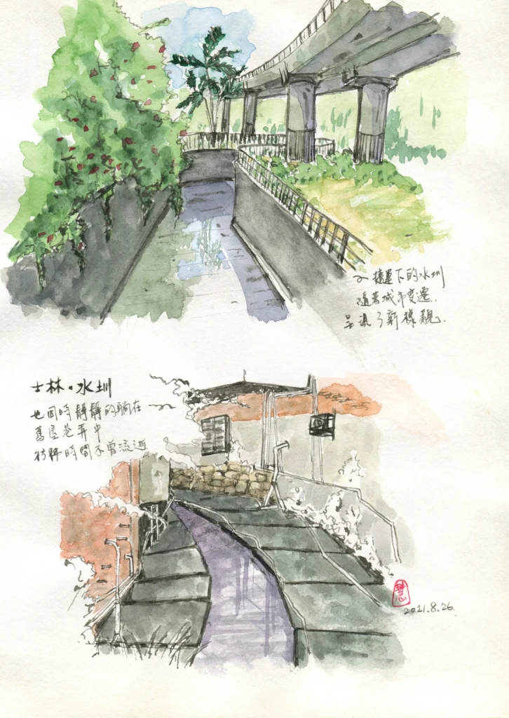
The main north branch continues to flow westward, via Fulin Road to the final open section of Fudeyang waterway, and then along the south lane of Zhongyong Street, it flows through Yunong Road and Xizhouzi, passing the Fulin Elementary School on the south side and the Shennong Palace of Shilin on the old street, before continuing on Wenlin Road to Shilin Elementary School. Afterward, it flows along Meilun Road, the north side of Huarong Market, Wenchang Road and the back of Shin Kong Wu Ho Shu Memorial Hospital (originally the Shin Kong Textile Factory). It then passes through the Meilun Park, the National Taiwan Science Education Center and the Taipei Children’s Amusement Park, before flowing through the long and narrow sandbar between the Keelung River and the Shuangxi near the Shuangxi Bridge (at the intersection of Section 6 of Chengde Road and Zhoumei Street). It will then irrigate the fields in Zhoumei and merge into the Keelung River. But in 1964, after the river cutoff of Shuangxi, the branch was directed into the Keelung River at the lower reaches of Shuangxi Bridge. It severed the channel of water from the Fudeyang waterway into Zhoumei.
| The Future
In recent years, Shilin Community College has conducted a series of field trip courses in Zhilan and invited many scholars and experts, including Chen Chunchin of Taipei National University of the Arts, Chen Chienyi of Taiwan Land Ethics Development Association, Chang Chinghung of Fulin Elementary School, etc., to lead the college students and the residents to explore or observe the natural ecology of the area, as well as explaining the literary and historical stories of the three canal branches in Zhilan.
In July 2021, Shilin Community College planned and carried out 12 sessions of the “Workshop of Knowledge and Mapping the History of the Fudeyang Waterway for the Present and the Future”, which was led by Lin Mingchi to discuss 17 issues of future vision and 16 related suggested topics on the Fudeyang waterway. The relevant information is hereby described as follows:
|★Fudeyang (The Recommendations). Overview of Citizens’ Written Opinions
1. [Recommendation] Inspect, Standardization¸ Rejuvenation of the Fudeyang Waterway
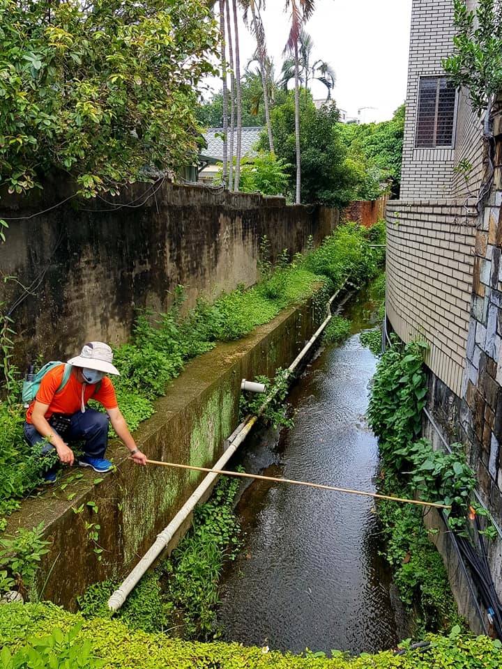
【Explanation】 The Fudeyang waterway, which was built in 1736, can be regarded as the earliest existing man-made building in Shilin. Before the completion of Shilin Waterway in 1911, it was the lifeblood of Shilin’s development. Unfortunately, due to urban development, it is now almost completely buried beneath the streets and buildings, except for some remnants out in the open, but their state of condition is still unclear. Modern exploratory technology should be used to comprehensively check the current state of the waterway infrastructures and further determine its position in the development of modern cities. Various infrastructures of the waterway will be marked for citizens to find and understand, providing them a way to trace the history of ancestors’ effort in land reclamation and cultivation. Or, the waterway can be re-activated for irrigating community gardens to beautify the city with natural plants, so that the waterway will continue to develop with Shilin!
【Location】 Fudeyang Waterway (Left Bank of the Shilin Shuangxi)
【Coordinates】 25.09456, 121.54542
【Writing】 WU,MEI-ZHEN (吳玫珍學員)
【Reviewed by】 LIN,MING-ZHI (林明志老師)
【Painting】CHEN,YUE-CHUN (陳月春學員)
【Edited by】HSIEH, I-CHING
【The Course】 The Workshop of Knowledge Mapping of the History of Fudeyang Waterway in Reflection of the Present and the Future
【Instructor on Literatures and History】 ZHANG,QING-HONG (張清鴻老師)
【Instructor on Ecology and Urban Development】 LIN,MING-ZHI (林明志老師)
【Affiliated with Shilin Community College, Taipei City】
【Extended link】
2.[Recommendation] Referencing the Planning of Store Signboards in Kyoto for the Shilin Storefronts around the Fudeyang Waterway
【Explanation】 These will be visually planned with care to preserve the unique local characteristics. For example, there has always been a detailed specification for business signs in the ancient capital of Japan, Kyoto! The Shilin Night Market, located in a section of the south branch of Fudeyang waterway, if completely demolished and re-constructed of Hokkien characteristics with distinctive signboards in accordance with market regulation of Kyoto, Japan, will have the opportunity to succeed in becoming a true unique local night market in the future. (Shilin of Zhangzhou style)
Location】 Shilin Night Market
【Coordinates】 25.08798, 121.5242
【Writing】ZHANG,XIN-XUE (張馨雪學員)
【Reviewed by】 LIN,MING-ZHI (林明志老師)
【Painting】LU,PEI-YING (魯培英學員)
【Edited by】HSIEH, I-CHING
【The Course】 The Workshop of Knowledge Mapping of the History of Fudeyang Waterway in Reflection of the Present and the Future
【Instructor on Literatures and History】 ZHANG,QING-HONG (張清鴻老師)
【Instructor on Ecology and Urban Development】LIN,MING-ZHI (林明志老師)
【Affiliated with Shilin Community College, Taipei City】
【Extended link】 http://Osaka.letsgojp.com
3.[Recommendation] National historic site of Chiang Kai-Shek Shilin Residence is not just about an official mansion
【Explanation】 The Chiang Kai-Shek Shilin Residence was once the official residence of the former President Chiang Kai-Shek and it was listed as a national historic site in 2005. In fact, the importance of this residence is that it is more than just a historic site. During the Qianlong reign of Qing Dynasty, the Fudeyang waterway passed in front of the its gate and its open river channel is still visible to this date. Its spring water was once sacred and reserved specifically to the deities of Taiwan Shrine. The Horiticultural Management Division was founded in 1908 and was later reorganized into one of the eight departments of the Agricultural Laboratory of Taiwan Soutokufu (including Shilin and Fengshan for gardening), which served as the research center for tropical plants and fruits. It was also the founding origin of Taiwan’s Orchid Kingdom in the 1990s. During the Second World War, Japan had a plan to move the seed-parent of orchids to Taiwan Soutokufu for preservation and a special research team was recruited at the Shilin branch of the Laboratory. These important historical events are also worthy of being included in the national archives.
【Location】 The Chiang Kai-Shek Shilin Residence
【Coordinates】 25.09307, 121.53239
【Writing】WU,MEI-ZHEN (吳玫珍學員)
【Reviewed by】 LIN,MING-ZHI (林明志老師)
【Painting】YANG,MEI-XUE (楊美雪學員)
【Edited by】HSIEH, I-CHING
【The Course】 The Workshop of Knowledge Mapping of the History of Fudeyang Waterway in Reflection of the Present and the Future
【Instructor on Literatures and History】 ZHANG,QING-HONG (張清鴻老師)
【Instructor on Ecology and Urban Development】LIN,MING-ZHI (林明志老師)
【Affiliated with Shilin Community College, Taipei City】
【Extended link】
4.[Recommendation] The urban development of the city, including the abandoned river channel in Shilin, still needs to improve on its user-friendliness
【Explanation】 At present, the old river course of the Keelung River is filled with many modern luxurious constructions, such as the planetarium, the science museum, the Children’s Amusement Park and a 10,000-acre Meilun Science Park, which are all half an hour away from my home. More than 30 years ago, the old river course of the Keelung River was dirty and messy and reeked with bad stench in summer. After it was filled up, many buildings were constructed in its place. But, with its soft fill-in soil, I have personally seen building collapsed. And, it is hard to believe that buildings are continuing to be built on such ground. The urban construction on Jihe Road is simply insufficient and unfriendly to users as sidewalks are often occupied by car washes, repair shops and unloading/loading trucks for businesses, where the government chose to ignore it. It is still quite unimaginable even to this day!
【Location】 Abandoned River Course of the Keelung River in Shilin (part of Phase II Municipal Land Consolidation Project for Shilin District)
【Coordinates】 25.09134, 121.52153
【Writing】HE,JIN-XUN (何金巡學員)
【Reviewed by】 LIN,MING-ZHI (林明志老師)
【Painting】SHEN,XUE-RU (沈雪茹學員)
【Edited by】HSIEH, I-CHING
【The Course】 The Workshop of Knowledge Mapping of the History of Fudeyang Waterway in Reflection of the Present and the Future
【Instructor on Literatures and History】 ZHANG,QING-HONG (張清鴻老師)
【Instructor on Ecology and Urban Development】LIN,MING-ZHI (林明志老師)
【Affiliated with Shilin Community College, Taipei City】
【Extended link】
5.[Recommendation] Gene Fort for Gene Protection
【Explanation】
◎ As looking back on the scene of the Fudeyang waterway 300 years ago, it was with forest full of orchids, giant woods at the small watershed, and big perch eels in the Shuangix River!
◎ Nowadays, due to urban development, the native ecosystem has been destroyed, despite there are graveyard, military land and still ponds that have been left untapped, which could still retain some of original species; or there may come a day when the government changes the land use to preserve both land and aquatic animals. It is imperative to designate a consecrated area to protect these species!
◎ It can expected to look forward to the establishment of an off-site seed conservation base in the Chiang Kai-Shek Shilin Residence to serve as a provenance bank for the restoration of a sustainable ecosystem in Shilin.One day, it may even be possible for native species to return to their original habitat, which may prove useful to increase these species in the threat of climate change!
【Location】 The Chiang Kai-Shek Shilin Residence
【Coordinates】 25.09307, 121.53239
【Writing】WU,GUI-XIA (吳桂蝦學員)
【Reviewed by】 LIN,MING-ZHI (林明志老師)
【Painting】YANG,MEI-XUE (楊美雪學員)
【Edited by】HSIEH, I-CHING
【The Course】The Workshop of Knowledge Mapping of the History of Fudeyang Waterway in Reflection of the Present and the Future
【Instructor on Literatures and History】 ZHANG,QING-HONG (張清鴻老師)
【Instructor on Ecology and Urban Development】LIN,MING-ZHI (林明志老師)
【Affiliated with Shilin Community College, Taipei City】
【Extended link】
6.[Recommendation] Old Photos Recollect the memories of Fudeyang waterway in the Local Story Workshop
【Explanation】 The Fudeyang waterway used to be the most important water source for irrigation in Shilin District, but only few people know its historical stories that even most residents in Shilin District do not know about. It is recommended that in addition to the workshop organized by the community college, local residents who are called upon by the chief of village will participate in the workshop or other humanities and history courses, where elderly friends of the community will be invited to tell the local stories or collect relevant old photographs of the past, in order for the story of Fudeyang waterway and its people can live on in memories.
【Location】 Neighborhood communities around the Fudeyang waterway system
【Coordinates】 25.09456, 121.54542
【Writing】YE,SHU-LIAN (葉淑蓮學員)
【Reviewed by】 LIN,MING-ZHI (林明志老師)
【Painting】CHEN,JIA-HUI (陳佳慧學員)
【Edited by】HSIEH, I-CHING
【The Course】 The Workshop of Knowledge Mapping of the History of Fudeyang Waterway in Reflection of the Present and the Future
【Instructor on Literatures and History】 ZHANG,QING-HONG (張清鴻老師)
【Instructor on Ecology and Urban Development】LIN,MING-ZHI (林明志老師)
【Affiliated with Shilin Community College, Taipei City】
【Extended link】
In addition to scholars’ and experts’ explanation of the formation of mountains and fault lines in the area, these teachers have also shared many historical accounts and their personal life experiences, which further strengthen the students’ impression of the courses. For example: The teacher, Chang Chinghung of Fulin Elementary School continued to emphasize the importance of ecology because some people will improperly introduce foreign species to Taiwan’s ecosystem for their own personal preference or interest. It is everyone’s responsibility to respect ecology and it is everyone’s obligation to protect native species!
| 參考資料 |
網站出版日期:2022年10月
1.士林學系列:走讀基隆河篇,陳健一 。
2.尋跡芝蘭•翻轉士林–粼社區誌,2020年9月版。
3.尋探大河史脈下的芝蘭三百年工作坊,陳健一老師(2020年07月21日至08月25日)
4.福德洋圳走讀:士林福林國小自然科張清鴻老師(2021年05月04日)
5.2021年7月士林社區大學規劃,並邀請林明志老師進行12堂的「福德洋圳鑑古至今擘未來–知識地圖種子工作坊」,討論出17個福德洋圳願景及16個建議議題。
版權所有,如須引用或轉載,請聯繫臺北市士林社區大學並註明出處。